Checked October 11, 2026, against Ulster County’s trail pages and NYC DEP. Rules can change, so check the county page before you drive.
In 2011, Hurricane Irene and Tropical Storm Lee took out the Boiceville Trestle, an Ulster & Delaware Railroad bridge over the Esopus Creek that had stood since around 1870. For eight years there was a gap over the creek. Then in 2019 Ulster County built a new bridge in its place, a three-span steel girder bridge 7 feet higher and 60 feet longer than the trestle it replaced, and opened the Ashokan Rail Trail across it. Now you can walk the old rail bed for 11.5 miles along the north shore of the Ashokan Reservoir, ground the public couldn’t reach without a DEP permit for more than a century.
This guide covers the trail, its three trailheads and the rules that keep it open. Boiceville is the western end, about 10 minutes from Phoenicia. If you’re staying in the valley, our Phoenicia field guide covers the village, and the Woodstock field guide picks up near the eastern end. Our cabin, Clove Creek in Hunter, NY, is about 25 minutes from the Boiceville lot.
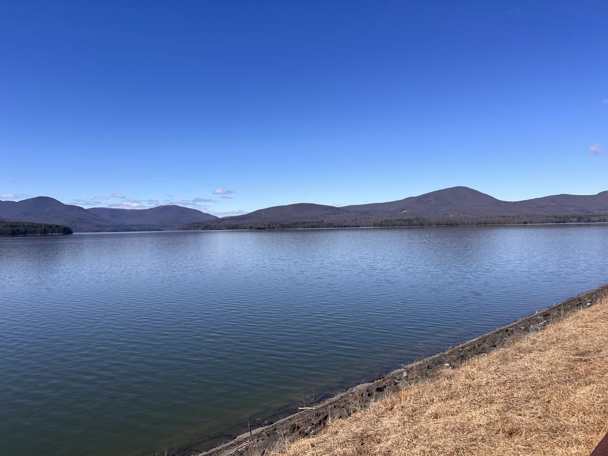
Ashokan Rail Trail at a glance
- Length: 11.5 miles one way, Boiceville to West Hurley. No loop.
- Surface: 12 feet wide, compacted crushed stone, flat. The trail and trailhead parking are ADA accessible.
- Hours: sunrise to sunset, all year.
- Fee: none, and no permit needed to stay on the trail.
- Uses: walking, running, biking, cross-country skiing and snowshoeing. Dogs on a leash.
- Facilities: portable toilets at each trailhead, nothing in between, no running water.
- From Clove Creek: about 25 minutes to Boiceville, 40 to the Woodstock Dike end.
The three trailheads
1. Boiceville Bridge, the western end
Trailhead · Boiceville Bridge
- Address: 5080 Route 28A, Olive, NY 12412.
- The bridge: a few minutes’ walk east from the lot, over the Esopus Creek.
- Facilities: portable toilets, a dog waste station, plowed in winter.
- From Clove Creek: about 25 minutes, down Route 214 and east on Route 28.
- From Phoenicia: about 10 minutes east on Route 28.
Start here if you only have an hour. The bridge comes almost right away. Upstream, the Esopus bends out of the mountains. Downstream, it runs into the reservoir’s west basin. The interpretive sign at the bridge has photos of the old trestle around 1910 and after it collapsed in 2011. It also explains that a hamlet called Boiceville stood near here, with houses, stores, a blacksmith and a tannery, until the reservoir forced its residents to move. Stone walls and foundations from it are still in the woods. The Boiceville you drive through today on Route 28 grew up after that.
Past the bridge the trail swings east along the water. It’s an easy out and back to wherever you’d like to turn around. The farther you go, the fewer people you’ll see.
2. Ashokan Station, the middle
3045 Route 28, Olive. The railroad was moved here in 1913, when the reservoir flooded the old route in the valley. Six local stations closed, and two new ones opened at Ashokan and West Hurley.
3. Woodstock Dike, the eastern end
1285 Route 28, Hurley, across from the West Hurley post office. This is the trailhead closest to Woodstock, about 10 minutes, and the closest to the Thruway. The trail’s mileposts carry a “K” for Kingston, where the railroad started at milepost 0 on the Hudson. The trail runs from just west of milepost 10 here to milepost 21.5 at Boiceville.
The rules, and why they’re strict
The trail is on New York City watershed land. The Ashokan Reservoir has been in service since 1915. The city’s Department of Environmental Protection says it holds about 128 billion gallons and supplies about 40 percent of the city’s drinking water on a typical day. The trail exists because Ulster County and DEP agreed on how to share that land, and the rules are part of the deal.
- Stay on the trail. The shoreline and the woods beside the trail are off-limits without a DEP Access Permit, and even then only for fishing or hunting. DEP Police issue tickets.
- No swimming or wading, for people or dogs.
- No camping, cooking, fires, fireworks or drones.
- No alcohol, tobacco or vaping.
- No motor vehicles, except electric wheelchairs and other mobility devices. E-bikes are allowed for now.
- Park only in marked spots. Angler Parking needs a DEP tag.
- Pass on the left, keep right, and carry out everything you bring in.
In hunting season, permit holders can carry bows and firearms on the trail but can’t fire them on or across it. An orange layer is still a good idea in late fall. The full rules are on the Ulster County Ashokan Rail Trail page. To report a downed tree or a washout, call Ulster County DPW at (845) 340-3102.
Biking the Ashokan Rail Trail
The trail is flat and smooth, so a hybrid or gravel bike is plenty. Riding all 11.5 miles and back is a relaxed half day. The surface is stone, not pavement, so skinny road tires are a poor choice. Ring a bell or call out before you pass walkers, and slow down on the boardwalk and the bridges. If you’d rather pedal on the rails themselves, Rail Explorers runs railbikes on a different stretch of the same railroad near Phoenicia. Our Phoenicia guide has the details.
Things to do near the trail
Walk the Ashokan Promenade on the south shore
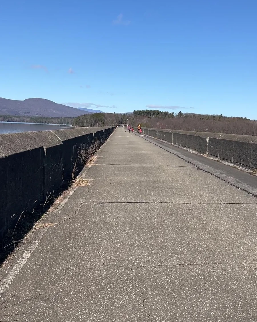
On the other side of the reservoir, DEP keeps a paved walkway on top of the Olivebridge Dam and the dikes, reached from two parking lots off Route 28A. Pair it with the rail trail and you’ve seen the reservoir from both sides in a day. It’s a separate DEP site with its own rules, so check DEP’s recreation page before you go.
The 7th anniversary walk and ride, October 18
Ulster County is marking seven years of the trail on Sunday, October 18, 2026, at the Boiceville trailhead, with food, traditional music and an afternoon on the trail. Times and details are on the county’s trail page.
Bread Alone in Boiceville
Bread Alone has baked in Boiceville since 1983. The bakery and cafe at 3962 Route 28 were rebuilt in 2021 and 2022 to run on electricity, with a big solar array and wood-fired brick ovens for the bread. It’s about two minutes from the trailhead. The bakery lists cafe hours of 7 to 5 daily, labeled spring and summer, and a wood-fired pizza stand Friday to Sunday, so check fall hours before you go.
Lunch in Phoenicia or Woodstock
Phoenicia is 10 minutes west and has the diner, pizza and a sit-down dinner. Woodstock is about 10 minutes from the eastern end. Our Phoenicia and Woodstock field guides have the places we’ve checked and their hours.
What we bring for the trail
Map
Catskill Park Trails Illustrated Map
National Geographic #755, waterproof. It shows the whole reservoir and the peaks you see across it, and paper doesn’t need a signal.
There’s no water on the trail, so bring a full bottle, plus a leash and bags if the dog’s coming. The rest of our list is on the Gear page.
Where to stay near the Ashokan Rail Trail
Our cabin · Hunter, NY · about 25 minutes to the Boiceville trailhead
Clove Creek Cabin
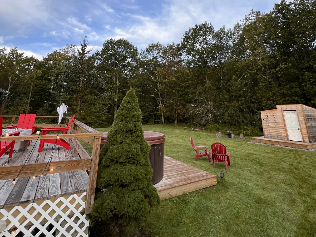
From the Boiceville Bridge trailhead it’s west on Route 28 to Phoenicia, then north up Route 214 to our door: about 14 miles and 25 minutes. The cabin sits between two creeks, with a hot tub, a sauna and an indoor fireplace, two queen bedrooms, an Ooni pizza oven and a Solo Stove fire pit on about 600 square feet of deck. Dogs are welcome when they’re on the reservation. There’s almost no cell service on 214, but the Wi-Fi is strong and handles Wi-Fi calling.
It suits two couples who want the bridge at nine, bread from Boiceville by noon and the sauna before dark.
Clove Creek is run by Unplugged Cabins, our sister brand.
Nearby · Tannersville · about 35 minutes to the Boiceville trailhead
Blue Heron
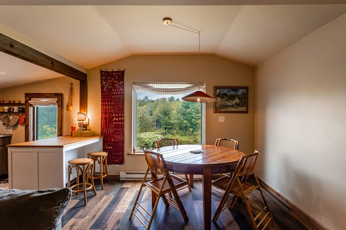
A quiet two-bedroom cabin a five-minute walk from Tannersville’s Main Street. Sleeps four, takes dogs, and has a fire pit and a real workspace. From Tannersville it’s Route 23A to Hunter, down Route 214 through the notch and east on Route 28: about 22 miles and 35 minutes to the Boiceville lot.
It suits a couple who want the reservoir by day and a walk to dinner on the Mountaintop at night.
Blue Heron and Clove Creek Cabin are about 12 minutes apart, so for a festival weekend or a group trip, book both.
Rather stay closer? Phoenicia, 10 minutes west of Boiceville, has a boutique hotel, a lodge and a bed and breakfast. They’re all in our Phoenicia field guide. For more ideas, see our Catskill cabin rentals guide.
Coming soon · Jefferson, NY · about 1 hr 20 min to the Boiceville trailhead
Juniper Ridge
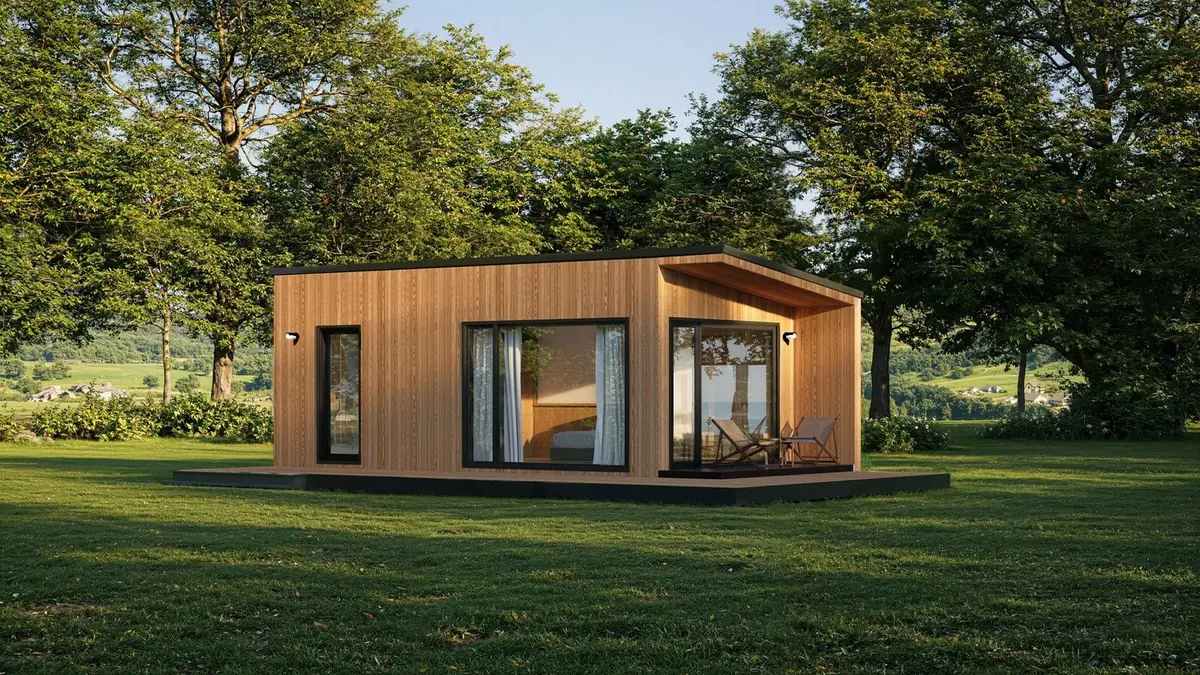
We’re building a modern tiny cabin on Blenheim Hill, near Jefferson in Schoharie County, on about five private acres of maple, beech and birch forest. It’s a single-story, 361-square-foot studio with a full bath, a kitchenette and a small covered porch. The plan includes a hot tub under the trees, a wood-fired sauna, a fire pit and a private trail through the woods.
- Getting there: about 1 hour 20 minutes to the Boiceville Bridge trailhead, by Route 30, then Routes 23, 23A, 42 and 28.
- Close by: Mine Kill State Park and Stamford, each about 15 minutes away.
- Where it stands: footings went in in September, and the cabin is being built in the workshop now. The opening date isn’t set yet.
It suits two people who want a quiet woods base in the northern Catskills, with the reservoir as a long day out.
It isn’t open yet. Join the list and you’ll hear first when it opens.
Juniper Ridge is run by Unplugged Cabins, our sister brand.
One perfect day
Bread and coffee at Bread Alone when it opens. At the Boiceville lot by 8:30, across the bridge before the crowds, and east along the water as far as your legs want to go. Back by noon, then 10 minutes west to Phoenicia for lunch. In the afternoon, drive around to the south shore for the promenade on the dam. Get back to the cabin before dark for the sauna.
Ashokan Rail Trail FAQ
How long is the Ashokan Rail Trail?
11.5 miles one way, from the Woodstock Dike trailhead in West Hurley to the Boiceville Bridge trailhead on Route 28A. It’s flat, 12 feet wide and surfaced in compacted crushed stone. There’s no loop, so the whole thing out and back is 23 miles. Most people walk a piece of it from one trailhead and turn around.
Where do you park for the Ashokan Rail Trail?
At one of three public trailheads: Boiceville Bridge (5080 Route 28A, Olive), Ashokan Station (3045 Route 28, Olive) and Woodstock Dike (1285 Route 28, Hurley). The spots marked Angler Parking need a DEP parking tag, and the county tickets everyone else who uses them.
What are the Ashokan Rail Trail hours?
Sunrise to sunset, every day of the year. The trailheads are plowed in winter, but the trail itself isn’t, so bring skis or snowshoes after a storm.
Are dogs allowed on the Ashokan Rail Trail?
Yes, on a leash. There are waste stations with bags at the trailheads. Dogs can’t go in the water. Swimming and wading are off-limits for people and pets, because this is New York City’s drinking water.
Can you swim or go down to the water at the Ashokan Reservoir?
No. Leaving the trail for the shoreline or other DEP land is prohibited unless you hold a DEP Access Permit and are actually fishing or hunting. DEP Police ticket for trespassing and for swimming or wading.
Are e-bikes allowed on the Ashokan Rail Trail?
For now, yes. The county says it may ban some classes of e-bike if speed becomes a safety problem, so check before you go. Other motor vehicles, including ATVs and snowmobiles, are banned.
Are there bathrooms on the Ashokan Rail Trail?
Portable toilets, including accessible ones, at each of the three trailheads. There’s nothing between them and no running water, so fill your bottles before you leave.