TRAILS · NORTHEAST · SUMMITS ·

Trails

Catskills in the fall: twenty hikes and paddles, about an hour from four home bases. Coffee after is on you.

Twenty fall hikes and paddles within about an hour of four home bases. Some are a stroll to a view; a few will make you earn the nap. Checked October 10, 2026. Drive times marked routed were measured trip by trip; the rest were picked off the map.

Pack list ↓ · Read before you go ↓

October 15 · Mine Kill boating ends

Published season ends October 15. Summer rental advertising is not confirmation of fall service.

October 31 · Schoharie boating ends

DEP access permit, boat tag and certified steam cleaning required. Plan logistics before arriving.

Cold water changes the outing

No fall swimming-hole recommendations. A sunny day does not make cold-water immersion safe.

Greene County · Hudson foothills

Leeds & Catskill

The most varied base: tidal creek paddles close by, escarpment views up the hill, and real mountain days a little farther west.

More on Morningside: Windham field guide

Plan the day

Gentle day: Kaaterskill viewing platform, then a North–South Lake shoreline picnic. Intermediate day: Acra Point. Water day: a reservation-confirmed guided Catskill Creek outing; do not add an open-Hudson crossing.

Kaaterskill Falls in autumn
Photo: Dougtone · CC BY-SA 2.0
HikeBeginner

Kaaterskill Falls viewing platform

Haines Falls · Greene

0.6 mi return · minimal gain · 30–60 min

Laurel House Road designated parking; gravel approach to the official viewing platform. Typical grade is 7%: short does not mean completely flat.

Field notes & caveats

This route ends at the platform, not the lower pools. May–October roadside pull-off parking in Kaaterskill Clove is prohibited. Flash floods, cliff restrictions and slippery footing warrant staying on marked trails. Check posted hours before visiting.

The Hudson Valley from the Mountain House site
Photo: Mwanner · CC BY-SA 3.0
HikeBeginner

Catskill Mountain House viewpoint

North–South Lake · Greene

0.5 mi return · 80 ft ascent · 30–60 min

Start at the gravel lot beyond North Lake Beach parking during vehicle-access season. Campground day-use fee applies; exact fee and daily gate hours must be checked.

Field notes & caveats

Big Hudson Valley views for a short walk. The off-season approach from South Lake dam parking is about 2 mi, not this half-mile route. Stay back from exposed ledges.

Blackhead Range in autumn, from the Escarpment Trail
Photo: Daniel Case · CC BY-SA 3.0
HikeIntermediate

Acra Point from Big Hollow

Maplecrest · Greene

3.4 mi return · 950 ft ascent · 2–3 hr

Big Hollow Road lot: 42.288561, -74.114842. Black Dome Trail north for 1 mi, then Escarpment Trail east for 0.7 mi; retrace. Free, year-round recreation.

Field notes & caveats

A compact escarpment climb rather than a casual stroll. Wet leaves conceal rocks and roots. Routed drives to the lot: Leeds 36 min; Jefferson 56 min. Allow extra time for parking.

Looking east over Platte Clove
Photo: Daniel Case · CC BY-SA 3.0
HikeIntermediate

Huckleberry Point

Elka Park · Greene

4.8 mi return · 644 ft outward-route gain* · 3–4 hr

Steenburg Road trailhead off Platte Clove Road. Blue Long Path 1 mi, then yellow trail 1.4 mi; return the same way.

Field notes & caveats

*DEC's 644 ft is not a complete cumulative round-trip gain; the return includes climbing. Unguarded cliffs. Approach through Tannersville if the steep eastern Platte Clove Road is closed or unsuitable. Check road and parking status.

North and South Lakes from North Point
Photo: Daniel Case · CC BY-SA 3.0
HikeIntermediate

North Point from Scutt Road

Haines Falls · Greene

4.6 mi return · gain not verified · 3–4 hr

Scutt Road parking. Rock Shelter Trail 1.3 mi, Mary's Glen Trail 0.8 mi, then Escarpment Trail 0.2 mi to North Point; reverse route.

Field notes & caveats

Rocky, climbing woodland walk to a broad lake-and-mountain view. Do not confuse this route with longer North Mountain loops. Avoid ledges in ice or high wind. Check current access before visiting.

Blackhead Mountain from the Black Dome summit
Photo: Kevin Kenny · CC BY-SA 2.0
HikeExpert

Black Dome from Big Hollow

Maplecrest · Greene

5.2 mi return · 1,725 ft ascent · 4–5 hr

Big Hollow Road lot; red Black Dome Trail south to the 3,980-ft summit, then return. Free, year-round recreation. Routed lot drives: Leeds 36 min; Jefferson 56 min.

Field notes & caveats

Expert tier here means a strenuous mountain day for experienced hikers, not technical climbing. Sustained steep terrain, early summit ice and limited daylight. Turn around if traction or conditions exceed your equipment and experience.

Windham High Peak via Peck Road: route sketchPECK RD LOTWINDHAM HIGH PEAK½ MIN ↑
Sketch, not for navigation · © OpenStreetMap
HikeIntermediate

Windham High Peak via Peck Road

Maplecrest · Greene

6.6 mi return · estimated 1,500–1,800 ft gain · 4–5 hr

Peck Road lot; Elm Ridge Trail 0.9 mi, then Escarpment Trail 2.4 mi to summit. Free, year-round recreation. Routed drive from Jefferson: 54 min.

Field notes & caveats

Strenuous intermediate / advanced. DEC's 1,494-ft ascent applies to the Escarpment segment, not clearly the entire outing. DEC reports the Elm Ridge–summit section reopened; still recheck before departure.

Colgate Lake
Photo: HannaElise · CC BY 2.0
PaddleBeginner

Colgate Lake

East Jewett · Greene

Small lake · choose 30–60 min · BYO boat

Free, year-round recreation; hand launch, no motors. County Route 78 lower lot: 42.235597, -74.122659. The closest accessible spaces are reserved for users with mobility impairments. Tannersville to lake routed 10 min, not a confirmed parking spot.

Field notes & caveats

Beginner terrain only in calm conditions with cold-water preparation. No rental service or swimming authorization verified. Check before visiting. Stay close to shore and turn back as wind builds.

North–South Lake
Photo: Mwanner · CC BY-SA 3.0
PaddleBeginner

North–South Lake

Haines Falls · Greene

Lake paddle · choose 1–2 hr · rentals conditional

No motors. North Lake paved ramp; South Lake accessible hand launch with kayak slide. DEC lists canoe/kayak/SUP rentals and May 15–October 25 facility dates, but the page extract does not identify the year. Call 518-589-5058.

Field notes & caveats

Rental dates, daily gate hours and exact day-use fee unverified: check before visiting. Lanesville to campground routed 21 min; internal launch travel extra. Swimming: DEC advises designated beaches only, unsupervised by lifeguards; prohibited 30 min before sunset through 30 min after sunrise. Not a fall swimming recommendation.

Lower Catskill Creek: route sketchCATSKILL CREEKHUDSON RIVERDUTCHMAN’S LANDING¼ MIN ↑
Sketch, not for navigation · © OpenStreetMap
PaddleIntermediate

Lower Catskill Creek

Catskill · Greene

Tidal creek · suggested 60–90 min · guide preferred

Dutchman's Landing municipal launch: 42.213118, -73.855206. Leeds to park routed 15 min. FlotSam describes creek out-and-back rentals; confirm opening, fall season, fees and launch operations before visiting.

Field notes & caveats

Tidal, not guaranteed flatwater: current, boat wakes and wind at the mouth. Inexperienced fall paddlers should book a guide or choose a lake. Do not drift onto the Hudson as an unplanned extension.

Hudson–Athens Lighthouse
Photo: MikeDNJ89 · CC BY-SA 4.0
PaddleExpert

Athens / Hudson River

Athens · Greene

Exposed tidal river · guided itinerary preferred

Athens NYS boat launch: 42.272987, -73.802254. This is different from Screaming Eagle's downtown launch at 19 S. Water Street. Guided trips are by appointment: 518-312-7729; current fall dates/prices unverified.

Field notes & caveats

Expert tier reflects tide, wind, wakes and channel traffic, not a whitewater grade. No self-guided lighthouse or shipping-channel crossing is recommended. Reserve with an outfitter and let conditions determine route and duration.

Greene County · Mountain top

Tannersville & Haines Falls

Short drives to mountain lakes and escarpment trails. Colgate Lake is the easiest bring-your-own-boat morning on the list.

More on Morningside: Tannersville field guide

Plan the day

Gentle day: Catskill Mountain House viewpoint and a short lakeshore walk. Mixed day: Huckleberry Point, then Colgate Lake only if weather, daylight and energy permit. Expert day: Hunter via Becker Hollow as the sole main activity.

Kaaterskill Falls in autumn
Photo: Dougtone · CC BY-SA 2.0
HikeBeginner

Kaaterskill Falls viewing platform

Haines Falls · Greene

0.6 mi return · minimal gain · 30–60 min

Laurel House Road designated parking; gravel approach to the official viewing platform. Typical grade is 7%: short does not mean completely flat.

Field notes & caveats

This route ends at the platform, not the lower pools. May–October roadside pull-off parking in Kaaterskill Clove is prohibited. Flash floods, cliff restrictions and slippery footing warrant staying on marked trails. Check posted hours before visiting.

The Hudson Valley from the Mountain House site
Photo: Mwanner · CC BY-SA 3.0
HikeBeginner

Catskill Mountain House viewpoint

North–South Lake · Greene

0.5 mi return · 80 ft ascent · 30–60 min

Start at the gravel lot beyond North Lake Beach parking during vehicle-access season. Campground day-use fee applies; exact fee and daily gate hours must be checked.

Field notes & caveats

Big Hudson Valley views for a short walk. The off-season approach from South Lake dam parking is about 2 mi, not this half-mile route. Stay back from exposed ledges.

Blackhead Range in autumn, from the Escarpment Trail
Photo: Daniel Case · CC BY-SA 3.0
HikeIntermediate

Acra Point from Big Hollow

Maplecrest · Greene

3.4 mi return · 950 ft ascent · 2–3 hr

Big Hollow Road lot: 42.288561, -74.114842. Black Dome Trail north for 1 mi, then Escarpment Trail east for 0.7 mi; retrace. Free, year-round recreation.

Field notes & caveats

A compact escarpment climb rather than a casual stroll. Wet leaves conceal rocks and roots. Routed drives to the lot: Leeds 36 min; Jefferson 56 min. Allow extra time for parking.

Looking east over Platte Clove
Photo: Daniel Case · CC BY-SA 3.0
HikeIntermediate

Huckleberry Point

Elka Park · Greene

4.8 mi return · 644 ft outward-route gain* · 3–4 hr

Steenburg Road trailhead off Platte Clove Road. Blue Long Path 1 mi, then yellow trail 1.4 mi; return the same way.

Field notes & caveats

*DEC's 644 ft is not a complete cumulative round-trip gain; the return includes climbing. Unguarded cliffs. Approach through Tannersville if the steep eastern Platte Clove Road is closed or unsuitable. Check road and parking status.

North and South Lakes from North Point
Photo: Daniel Case · CC BY-SA 3.0
HikeIntermediate

North Point from Scutt Road

Haines Falls · Greene

4.6 mi return · gain not verified · 3–4 hr

Scutt Road parking. Rock Shelter Trail 1.3 mi, Mary's Glen Trail 0.8 mi, then Escarpment Trail 0.2 mi to North Point; reverse route.

Field notes & caveats

Rocky, climbing woodland walk to a broad lake-and-mountain view. Do not confuse this route with longer North Mountain loops. Avoid ledges in ice or high wind. Check current access before visiting.

Blackhead Mountain from the Black Dome summit
Photo: Kevin Kenny · CC BY-SA 2.0
HikeExpert

Black Dome from Big Hollow

Maplecrest · Greene

5.2 mi return · 1,725 ft ascent · 4–5 hr

Big Hollow Road lot; red Black Dome Trail south to the 3,980-ft summit, then return. Free, year-round recreation. Routed lot drives: Leeds 36 min; Jefferson 56 min.

Field notes & caveats

Expert tier here means a strenuous mountain day for experienced hikers, not technical climbing. Sustained steep terrain, early summit ice and limited daylight. Turn around if traction or conditions exceed your equipment and experience.

Hunter Mountain summit
Photo: Jess Mann · CC BY-SA 4.0
HikeExpert

Hunter Mountain via Becker Hollow

Hunter · Greene

About 5.4 mi · 2,219 ft gain* · 4–6 hr

Use DEC's signed Route 214 trailhead, 42.181339, -74.196415. Do not follow a navigator onto private Lane Road. DEC's 2.2-mi Becker Hollow Trail ends at a junction, not at the fire tower.

Field notes & caveats

Very steep upper climb. *Distance/gain describe a summit-area loop in the supplementary route guide, not DEC measurements. Tower/cab opening not verified; check before visiting. Allow a full hiking day.

The view from the Hunter fire tower
Photo: Jess Mann · CC BY-SA 4.0
HikeIntermediate

Hunter Mountain via Spruceton

West Kill · Greene

6.8 mi return · gain not verified · 4–6 hr

Spruceton Road lot: 42.184566, -74.272038. Follow blue Spruceton Trail 3.4 mi one way along the old woods road to the fire tower.

Field notes & caveats

Strenuous intermediate / advanced outing: less steep than Becker Hollow, but long and high. DEC describes the route as moderately difficult. Cab access is not guaranteed. Finish well before darkness.

Diamond Notch Falls in autumn
Photo: Daniel Case · CC BY-SA 3.0
HikeBeginner

Diamond Notch Falls from Spruceton

West Kill · Greene

About 2 mi return · gain not verified · 1–1.5 hr

Start at the eastern end of Spruceton Road on the Diamond Notch Trail; DEC places the falls 1 mi from this end. This is not the longer approach from Lanesville's Diamond Notch Road.

Field notes & caveats

Beginner-plus: a natural forest trail with uneven footing, not an accessible promenade. Enjoy the waterfall from the trail; swimming permission was not verified. Free, year-round recreation; check trail conditions.

Colgate Lake
Photo: HannaElise · CC BY 2.0
PaddleBeginner

Colgate Lake

East Jewett · Greene

Small lake · choose 30–60 min · BYO boat

Free, year-round recreation; hand launch, no motors. County Route 78 lower lot: 42.235597, -74.122659. The closest accessible spaces are reserved for users with mobility impairments. Tannersville to lake routed 10 min, not a confirmed parking spot.

Field notes & caveats

Beginner terrain only in calm conditions with cold-water preparation. No rental service or swimming authorization verified. Check before visiting. Stay close to shore and turn back as wind builds.

North–South Lake
Photo: Mwanner · CC BY-SA 3.0
PaddleBeginner

North–South Lake

Haines Falls · Greene

Lake paddle · choose 1–2 hr · rentals conditional

No motors. North Lake paved ramp; South Lake accessible hand launch with kayak slide. DEC lists canoe/kayak/SUP rentals and May 15–October 25 facility dates, but the page extract does not identify the year. Call 518-589-5058.

Field notes & caveats

Rental dates, daily gate hours and exact day-use fee unverified: check before visiting. Lanesville to campground routed 21 min; internal launch travel extra. Swimming: DEC advises designated beaches only, unsupervised by lifeguards; prohibited 30 min before sunset through 30 min after sunrise. Not a fall swimming recommendation.

Ulster / Greene counties · Route 214 corridor

Lanesville & Hunter

Home of the steep Hunter Mountain routes. Paddle the managed mountain lakes; roadside creeks are not beginner water.

More on Morningside: Hunter field guide · Phoenicia field guide

Plan the day

Gentle day: Diamond Notch Falls from Spruceton, then a picnic. Intermediate day: North Point from Scutt Road. Expert day: Hunter via Becker Hollow, starting early; choose Spruceton for a longer, less steep alternative.

Kaaterskill Falls in autumn
Photo: Dougtone · CC BY-SA 2.0
HikeBeginner

Kaaterskill Falls viewing platform

Haines Falls · Greene

0.6 mi return · minimal gain · 30–60 min

Laurel House Road designated parking; gravel approach to the official viewing platform. Typical grade is 7%: short does not mean completely flat.

Field notes & caveats

This route ends at the platform, not the lower pools. May–October roadside pull-off parking in Kaaterskill Clove is prohibited. Flash floods, cliff restrictions and slippery footing warrant staying on marked trails. Check posted hours before visiting.

The Hudson Valley from the Mountain House site
Photo: Mwanner · CC BY-SA 3.0
HikeBeginner

Catskill Mountain House viewpoint

North–South Lake · Greene

0.5 mi return · 80 ft ascent · 30–60 min

Start at the gravel lot beyond North Lake Beach parking during vehicle-access season. Campground day-use fee applies; exact fee and daily gate hours must be checked.

Field notes & caveats

Big Hudson Valley views for a short walk. The off-season approach from South Lake dam parking is about 2 mi, not this half-mile route. Stay back from exposed ledges.

Blackhead Range in autumn, from the Escarpment Trail
Photo: Daniel Case · CC BY-SA 3.0
HikeIntermediate

Acra Point from Big Hollow

Maplecrest · Greene

3.4 mi return · 950 ft ascent · 2–3 hr

Big Hollow Road lot: 42.288561, -74.114842. Black Dome Trail north for 1 mi, then Escarpment Trail east for 0.7 mi; retrace. Free, year-round recreation.

Field notes & caveats

A compact escarpment climb rather than a casual stroll. Wet leaves conceal rocks and roots. Routed drives to the lot: Leeds 36 min; Jefferson 56 min. Allow extra time for parking.

Looking east over Platte Clove
Photo: Daniel Case · CC BY-SA 3.0
HikeIntermediate

Huckleberry Point

Elka Park · Greene

4.8 mi return · 644 ft outward-route gain* · 3–4 hr

Steenburg Road trailhead off Platte Clove Road. Blue Long Path 1 mi, then yellow trail 1.4 mi; return the same way.

Field notes & caveats

*DEC's 644 ft is not a complete cumulative round-trip gain; the return includes climbing. Unguarded cliffs. Approach through Tannersville if the steep eastern Platte Clove Road is closed or unsuitable. Check road and parking status.

North and South Lakes from North Point
Photo: Daniel Case · CC BY-SA 3.0
HikeIntermediate

North Point from Scutt Road

Haines Falls · Greene

4.6 mi return · gain not verified · 3–4 hr

Scutt Road parking. Rock Shelter Trail 1.3 mi, Mary's Glen Trail 0.8 mi, then Escarpment Trail 0.2 mi to North Point; reverse route.

Field notes & caveats

Rocky, climbing woodland walk to a broad lake-and-mountain view. Do not confuse this route with longer North Mountain loops. Avoid ledges in ice or high wind. Check current access before visiting.

Blackhead Mountain from the Black Dome summit
Photo: Kevin Kenny · CC BY-SA 2.0
HikeExpert

Black Dome from Big Hollow

Maplecrest · Greene

5.2 mi return · 1,725 ft ascent · 4–5 hr

Big Hollow Road lot; red Black Dome Trail south to the 3,980-ft summit, then return. Free, year-round recreation. Routed lot drives: Leeds 36 min; Jefferson 56 min.

Field notes & caveats

Expert tier here means a strenuous mountain day for experienced hikers, not technical climbing. Sustained steep terrain, early summit ice and limited daylight. Turn around if traction or conditions exceed your equipment and experience.

Hunter Mountain summit
Photo: Jess Mann · CC BY-SA 4.0
HikeExpert

Hunter Mountain via Becker Hollow

Hunter · Greene

About 5.4 mi · 2,219 ft gain* · 4–6 hr

Use DEC's signed Route 214 trailhead, 42.181339, -74.196415. Do not follow a navigator onto private Lane Road. DEC's 2.2-mi Becker Hollow Trail ends at a junction, not at the fire tower.

Field notes & caveats

Very steep upper climb. *Distance/gain describe a summit-area loop in the supplementary route guide, not DEC measurements. Tower/cab opening not verified; check before visiting. Allow a full hiking day.

The view from the Hunter fire tower
Photo: Jess Mann · CC BY-SA 4.0
HikeIntermediate

Hunter Mountain via Spruceton

West Kill · Greene

6.8 mi return · gain not verified · 4–6 hr

Spruceton Road lot: 42.184566, -74.272038. Follow blue Spruceton Trail 3.4 mi one way along the old woods road to the fire tower.

Field notes & caveats

Strenuous intermediate / advanced outing: less steep than Becker Hollow, but long and high. DEC describes the route as moderately difficult. Cab access is not guaranteed. Finish well before darkness.

Diamond Notch Falls in autumn
Photo: Daniel Case · CC BY-SA 3.0
HikeBeginner

Diamond Notch Falls from Spruceton

West Kill · Greene

About 2 mi return · gain not verified · 1–1.5 hr

Start at the eastern end of Spruceton Road on the Diamond Notch Trail; DEC places the falls 1 mi from this end. This is not the longer approach from Lanesville's Diamond Notch Road.

Field notes & caveats

Beginner-plus: a natural forest trail with uneven footing, not an accessible promenade. Enjoy the waterfall from the trail; swimming permission was not verified. Free, year-round recreation; check trail conditions.

Colgate Lake
Photo: HannaElise · CC BY 2.0
PaddleBeginner

Colgate Lake

East Jewett · Greene

Small lake · choose 30–60 min · BYO boat

Free, year-round recreation; hand launch, no motors. County Route 78 lower lot: 42.235597, -74.122659. The closest accessible spaces are reserved for users with mobility impairments. Tannersville to lake routed 10 min, not a confirmed parking spot.

Field notes & caveats

Beginner terrain only in calm conditions with cold-water preparation. No rental service or swimming authorization verified. Check before visiting. Stay close to shore and turn back as wind builds.
North–South Lake
Photo: Mwanner · CC BY-SA 3.0
PaddleBeginner

North–South Lake

Haines Falls · Greene

Lake paddle · choose 1–2 hr · rentals conditional

No motors. North Lake paved ramp; South Lake accessible hand launch with kayak slide. DEC lists canoe/kayak/SUP rentals and May 15–October 25 facility dates, but the page extract does not identify the year. Call 518-589-5058.

Field notes & caveats

Rental dates, daily gate hours and exact day-use fee unverified: check before visiting. Lanesville to campground routed 21 min; internal launch travel extra. Swimming: DEC advises designated beaches only, unsupervised by lifeguards; prohibited 30 min before sunset through 30 min after sunrise. Not a fall swimming recommendation.
Schoharie / Delaware counties · Northern hills

Jefferson & Blenheim

Quiet ponds, a state park ten minutes away and reservoir paddling with its own rules. The big Catskill hikes sit near the one-hour line.

More on Morningside: Windham field guide

Plan the day

Gentle day: Mine Kill Falls plus a park picnic. Water day before October 15: reservation-confirmed or BYO Mine Kill paddle after boat wash. Later October: permitted Schoharie Reservoir outing or Looking Glass Pond. Mountain day: Black Dome or Windham High Peak, not both.

Blackhead Range in autumn, from the Escarpment Trail
Photo: Daniel Case · CC BY-SA 3.0
HikeIntermediate

Acra Point from Big Hollow

Maplecrest · Greene

3.4 mi return · 950 ft ascent · 2–3 hr

Big Hollow Road lot: 42.288561, -74.114842. Black Dome Trail north for 1 mi, then Escarpment Trail east for 0.7 mi; retrace. Free, year-round recreation.

Field notes & caveats

A compact escarpment climb rather than a casual stroll. Wet leaves conceal rocks and roots. Routed drives to the lot: Leeds 36 min; Jefferson 56 min. Allow extra time for parking.

Blackhead Mountain from the Black Dome summit
Photo: Kevin Kenny · CC BY-SA 2.0
HikeExpert

Black Dome from Big Hollow

Maplecrest · Greene

5.2 mi return · 1,725 ft ascent · 4–5 hr

Big Hollow Road lot; red Black Dome Trail south to the 3,980-ft summit, then return. Free, year-round recreation. Routed lot drives: Leeds 36 min; Jefferson 56 min.

Field notes & caveats

Expert tier here means a strenuous mountain day for experienced hikers, not technical climbing. Sustained steep terrain, early summit ice and limited daylight. Turn around if traction or conditions exceed your equipment and experience.

Looking Glass Pond shoreline walk: route sketchLOOKING GLASS PONDROSSMAN HILL RD¼ MIN ↑
Sketch, not for navigation · © OpenStreetMap
HikeBeginner

Looking Glass Pond shoreline walk

Fulton · Schoharie

Choose 0.5–1 mi return · gain unverified · 30–60 min

Rossman Hill Road recreation area in Burnt-Rossman Hills State Forest. Use an out-and-back from the pond access rather than assuming a maintained complete loop.

Field notes & caveats

Distance is an outing suggestion, not an agency-measured route. Viewing platforms and accessible facilities do not make every shoreline path accessible. Bring bright clothing in hunting season. Daily hours unverified: check before visiting.
Mine Kill Falls, October
Photo: 420Traveler · CC BY-SA 4.0
HikeBeginner

Mine Kill Falls overlooks

North Blenheim · Schoharie

Short overlook visit · mileage/gain unverified · 30–60 min

Separate waterfall parking area about a quarter-mile south of the main park entrance, not the reservoir boat launch. Falls access: dawn to dusk, year-round, weather permitting. No vehicle entrance fee.

Field notes & caveats

Use overlooks for the easier visit. The trail toward the lower falls adds slope and slippery footing, so it is not equivalent in difficulty. Main park routed about 10 min from Jefferson; allow extra travel to the separate falls lot. No swimming recommendation.

The Mount Utsayantha fire tower
Photo: Brendan J. O'Reilly · CC BY-SA 3.0
HikeIntermediate

Mount Utsayantha road walk

Stamford · Delaware

About 2–2.3 mi return · about 680 ft gain · 1–1.5 hr

Walk the gravel access road from a lawful base parking location. County tourism describes the village summit park; exact base parking and current gate/tower status need confirmation.

Field notes & caveats

A steady uphill road walk sharing space with vehicles when the road is open. Do not park in or block private drives. The routing service led toward the summit, so no verified trailhead drive time is claimed.

Windham High Peak via Peck Road: route sketchPECK RD LOTWINDHAM HIGH PEAK½ MIN ↑
Sketch, not for navigation · © OpenStreetMap
HikeIntermediate

Windham High Peak via Peck Road

Maplecrest · Greene

6.6 mi return · estimated 1,500–1,800 ft gain · 4–5 hr

Peck Road lot; Elm Ridge Trail 0.9 mi, then Escarpment Trail 2.4 mi to summit. Free, year-round recreation. Routed drive from Jefferson: 54 min.

Field notes & caveats

Strenuous intermediate / advanced. DEC's 1,494-ft ascent applies to the Escarpment segment, not clearly the entire outing. DEC reports the Elm Ridge–summit section reopened; still recheck before departure.

Looking Glass Pond: route sketchLOOKING GLASS PONDROSSMAN HILL RD¼ MIN ↑
Sketch, not for navigation · © OpenStreetMap
PaddleBeginner

Looking Glass Pond

Fulton · Schoharie

22-acre pond · choose 30–60 min · BYO boat

DEC hand launch off Rossman Hill Road. No local rental operation verified. Daily hours and launch condition unverified: check before visiting.

Field notes & caveats

Best small-water candidate from Jefferson in calm weather. Not an NYC reservoir, so the Schoharie Reservoir DEP permit process does not apply. Swimming permission not verified. Cold-water gear remains necessary.

Blenheim–Gilboa Lower Reservoir: route sketchLOWER RESERVOIRMINE KILL LAUNCH½ MIN ↑
Sketch, not for navigation · © OpenStreetMap
PaddleIntermediate

Blenheim–Gilboa Lower Reservoir

Mine Kill State Park · Schoharie

Suggested 1–2 hr · boating April 1–October 15

Mine Kill launch: sign in and hot-water wash your boat before AND after reservoir use. No boating permit needed. Launch opens 7:30 am; boats off one hour before park closing. Call 518-827-8690 for that day's closing time and any restrictions.

Field notes & caveats

About 10 min to park from Jefferson, extra to launch. Rentals advertised for summer only: fall rentals unverified, check before visiting. Not an outing for after October 15 under the published schedule. Wind, motorboats and operational restrictions matter.

Gilboa Dam, Schoharie Reservoir
Photo: Austin512 · Public domain
PaddleIntermediate

Schoharie Reservoir

Prattsville / Gilboa · Greene / Schoharie

Suggested 1–2 hr · season May 1–October 31

Use a designated launch such as Devasego Park or Snyder's Cove. Free DEP Access Permit, recreational boat tag and certified steam cleaning of boat/paddles required. Kayaks minimum 9 ft; other allowed recreational boats minimum 11 ft 5 in. Nonmotorized; no sailboats.

Field notes & caveats

Removing the boat from reservoir property means another steam cleaning before return. No vehicle/trailer in water. Confirm launch-specific access and cleaning appointment. Fall rental availability unverified; CWC lists vendors. Open water can be too windy for beginners. No reservoir swimming.

Sleep closer to the trailheads

Clove Creek Cabin, Lanesville

Ten minutes from the Hunter trails: hot tub, sauna, a fireplace and two creeks. Booked through our friends at Unplugged Cabins.

See the cabin at Unplugged Cabins ↗

Want it on paper?

The printable field guide

Same twenty outings with route sketches by home base, from Unplugged Cabins.

Unplugged Cabins field guide ↗

This weekend

Fairs, concerts, foliage trains

What’s on within two hours, picked each week.

Unplugged Cabins weekend picks ↗

Rained out?

Find an indoor court

A wet Saturday is a fine day for pickleball.

Pickleball Near Me court finder ↗

Pack list

Pack like the phone will quit

It will, somewhere past the last gas station. What this guide keeps telling you to carry. Our own picks live on Gear.

The no-signal pick

Offline GPS or a satellite messenger

No bars is the point of the trip, not an emergency plan. A handheld GPS keeps your track with zero signal; a satellite messenger can text and send an SOS where phones can’t.

Headlamp

October light quits early. Every mountain card says finish before dark; pack a light anyway.

All hikes

Best sellers on Amazon ↗

Warm and rain layers

Wet leaves, wind on the ledges, summits that run colder than the lot.

All hikes

Best sellers on Amazon ↗

Traction spikes

Early ice shows up on the high summits first.

Black Dome, Hunter, Windham

Best sellers on Amazon ↗

Life vest (PFD)

Worn, not stowed. Cold water is the real fall hazard.

All paddles

Best sellers on Amazon ↗

Dry bag

Keys, a warm layer and a paper map stay dry if you swim by accident.

All paddles

Best sellers on Amazon ↗

Blaze-orange hat

Hunting season on most of this land. Be easy to see.

State and wild forest

Best sellers on Amazon ↗

Maps & books

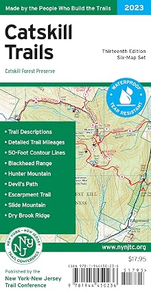
Cover of Catskill Trails map set

Catskill Trails map set

NY-NJ Trail Conference · 13th edition, 2023

Six waterproof maps with trail mileage and 50-ft contours. The one that lives in the pack.

Find it on Amazon ↗Or buy it from the Trail Conference ↗
Cover of Hiking the Catskills

Hiking the Catskills

Randi Minetor and Stacey Freed · FalconGuides, 2022

40 hikes, from the 3,500-ft peaks to short walks that end at a view and a sandwich.

Find it on Amazon ↗
Cover of Hiking Waterfalls New York

Hiking Waterfalls New York

Randi Minetor · FalconGuides, 3rd edition, 2025

Statewide, with a Catskills chapter and GPS coordinates for the falls.

Find it on Amazon ↗

The fine print

Read before you go

Difficulty describes terrain in dry, unfrozen conditions—not your fitness or today’s safety. Beginner paddling still requires PFDs, cold-water clothing and self-rescue skills. Wear PFDs throughout; postpone in strong wind, floodwater, thunderstorms or conditions beyond your training. No cliff jumping, waterfall scrambling or unverified swimming holes are recommended. Mountain hikes need offline navigation, headlamp, layers, food, water and a turnaround time; wet leaves and early ice can change the grade. Wear bright colors where hunting is allowed. All hike durations are planning estimates, excluding long breaks. Most distances are round-trip; exceptions and unverified gains are labelled.

Access, not assumptions

  • Research is not a real-time opening guarantee. Check each linked land-manager page and posted signs on your departure day. Unconfirmed hours, fees, rentals and tower access are explicitly flagged.
  • Ashokan is not in DEP’s general recreational kayaking program. Do not confuse angler-boat rules with recreational access.
  • North–South Lake is the only swimming location here with explicit first-party swimming guidance; that does not make it a recommended fall swim. Colgate and Looking Glass Pond swimming permission was not verified.
  • Fawn’s Leap and Kaaterskill swimming holes are excluded: cliff restrictions, flash-flood exposure and legal parking limitations make casual recommendations inappropriate.
  • Drive times marked routed were checked one trip at a time; there is no full four-base drive-time table. Navigate to the trailhead or launch itself, not the town.
  • Emergency: call 911. DEC Forest Rangers: 1-833-697-7264. Do not rely on cell service.

Home bases: Leeds, Tannersville, Lanesville and Jefferson. Places within reach of two bases appear under both. Photos from Wikimedia Commons (photographer and license on each). Route sketches from OpenStreetMap data (© OpenStreetMap contributors, ODbL); not for navigation.

Trail of the month

Kaaterskill Falls

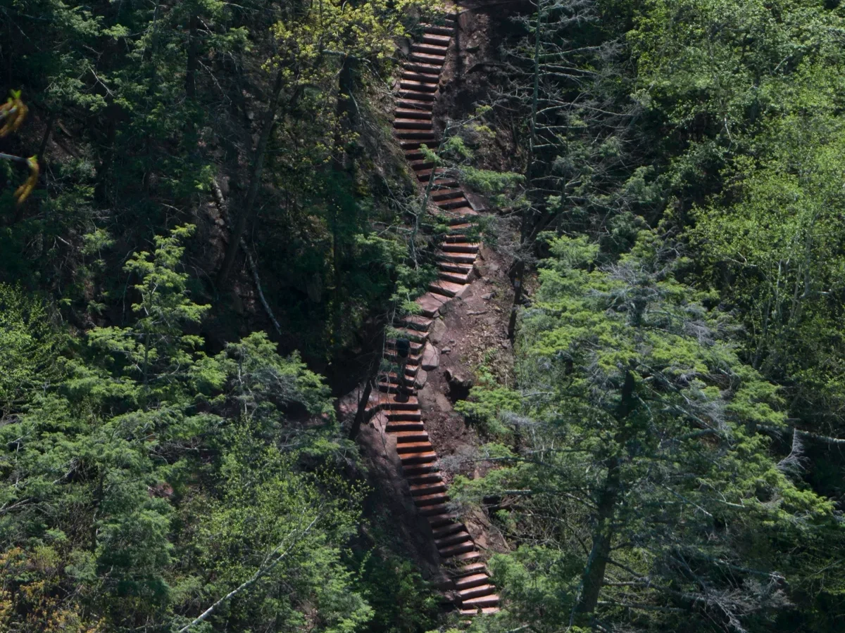
0.3 mi to the platform; about 0.7 mi to the base (one way) Easy to the platform; moderate to the base 260-foot two-tier waterfall with an accessible viewing platform

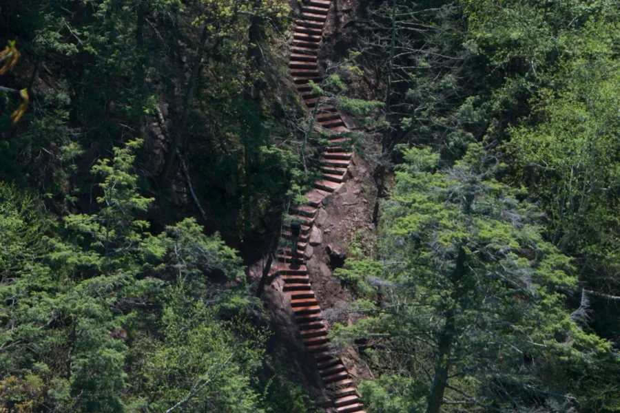
The easy way to the viewing platform, the stairs to the base, where to park legally, and the Route 23A tow warning.

Get the trail notes
Stone and timber stairs climbing through the forest on the trail to Kaaterskill Falls
  • Kaaterskill Falls

    Kaaterskill Falls

    The easy way to the viewing platform, the stairs to the base, where to park legally, and the Route 23A…

  • Ashokan Rail Trail

    Ashokan Rail Trail

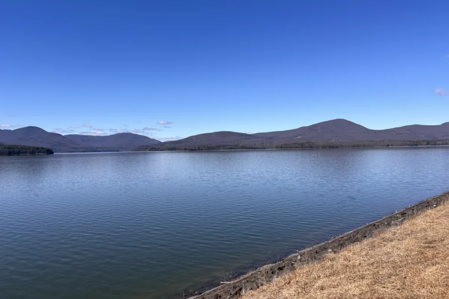
    11.5 flat miles along the Ashokan Reservoir between Boiceville and West Hurley: trailheads, hours, dogs and the DEP rules.